
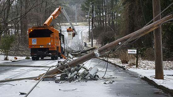
 How to survive a power outage in winte
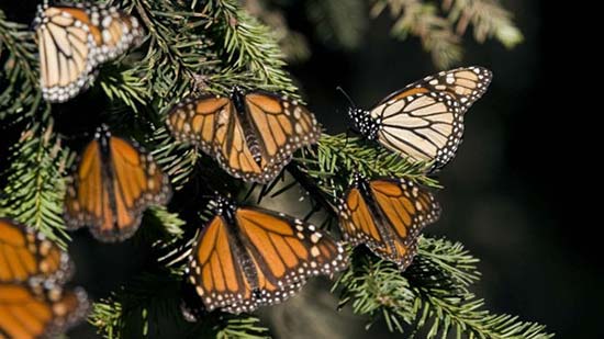 Monarch Butterflies That Should Have Migrated South Have Yet to Leave Canada
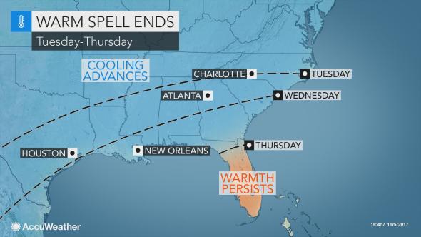 Rain, cooler air to sweep record-challenging warmth out of southern US this week
 Franken-Philippe Bringing Damaging Winds
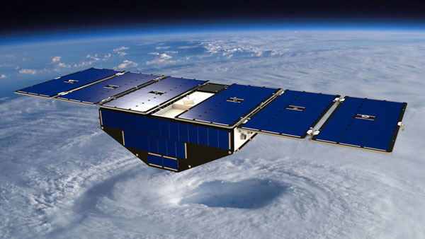
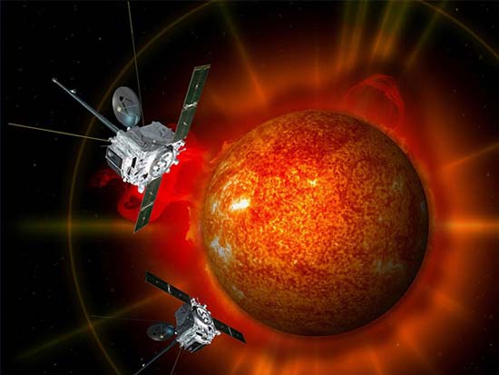 Exploring Solar Storms
 Tropical Storm Philippe Drenches Florida and Cuba
 Hole in the ozone layer over Antarctica
 The history of the barometer
Learn how technology has changed weather forecasting
Weather observing started with simply stepping outside and noting what was seen, heard, and felt. Instruments such as the thermometer, anemometer, and rain gauge, developed in the 15th through 17th centuries.
Once the telegraph and telephone were invented, observations from various different locations were able to be gathered together and actually used in making forecasts. These forecasts were able to then be communicated from place to place and to a wider audience. Weather systems that were previously not known were now able to be tracked and charted over distance and time. And national weather maps were able to be created with much greater detail.
In the 1920s weather balloons, which would provide weather data such as temperature and wind at various levels of the atmosphere, were launched from different locations. Once we had this upper air data, the first forecast models were devised. By the late 1940s weather radar was launched. By the late 1980s “Doppler” radar was developed and the National Weather Service came up with a plan to set these radar sites up at different locations to provide nearly nation-wide radar coverage. Radar now allowed meteorologists to view and display severe weather systems as well. This increased the accuracy and timing of weather watches and warnings. We were now able to give people advanced warning on Thunderstorms and tornadoes like we never even imagined.
By the 1950s, numerical forecasts (models) were being done on a daily basis. Now, our short and medium range models are prepared at least four times per day with computers taking much less time to display and disseminate the information. Many shorter range models are issued even more often. Now with wide use of the internet, many websites actually give users access to these models and their forecast output.
The ability to view weather systems and clouds from outer space was a momentous occasion in the world of meteorology. In 1960, TIROS-1 took the first satellite image of the clouds and sent it down to earth. These early satellites were what was called “polar orbiters” and they would provide a photo once or twice a day. Satellite continued to advance over the late 20th and now 21st centuries to not only provide cloud images, but other atmospheric conditions, similar to that provided by weather balloons. This data is available through satellite observations at a wider range of locations and more often as well.
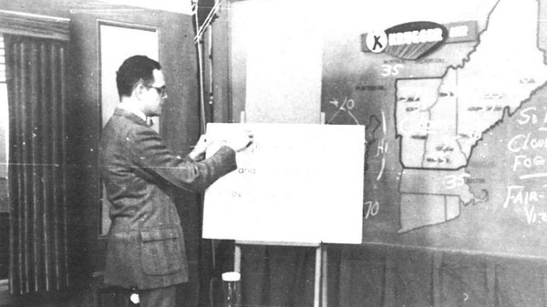
Through all of this development, the way we delivered forecasts to the public also changed dramatically. The first weathercasts were broadcast on radio during the 1920s. Television developed in the 1940s and 50s giving birth to a new way of “showing” the weather. These TV weathercasts allowed forecast information to be delivered to an even wider audience. Television weathercasts started out with a few rudimentary graphics such as a paper weather map and a wipe-board with some current temperatures. Forecasts were drawn by hand onto weather maps using markers and magnets. By the 1980s meteorologists began using computer displays for weather information. This allowed more information to be displayed in a shorter amount of time.
Today’s television weather systems are not only used to make and display weather graphics, but also to forecast weather by meteorologists. These advanced weather systems allow satellite, radar, and even forecast model information to be broadcast over the airwaves. The timing of these technologically advanced systems corresponded perfectly with the development and use of the internet. Now a greater audience than ever before has access to weather information and forecasts. WMTW even has a dedicated “weather app” for up to the minute information, conditions and forecasts.
Sources: NOAA.gov and NASA.gov